At some point it seems that Google Maps stopped chasing waterfalls and in the process stopped sticking to the rivers and lakes (and streams) that they’re used to and pretty much gave up on naming a variety of watercourses. You’ll never guess where I had to turn to to get the information that Google couldn’t supply.
So last night a friend up in Mentone, Alabama, posted a photo from the back porch of the place she and her husband have up in that small community. I was amazed to see that they were backed onto a body of water, because they’re up at the top of some pretty steep terrain. This morning I went back and looked at the photo and she indicated that they were on the Little River.
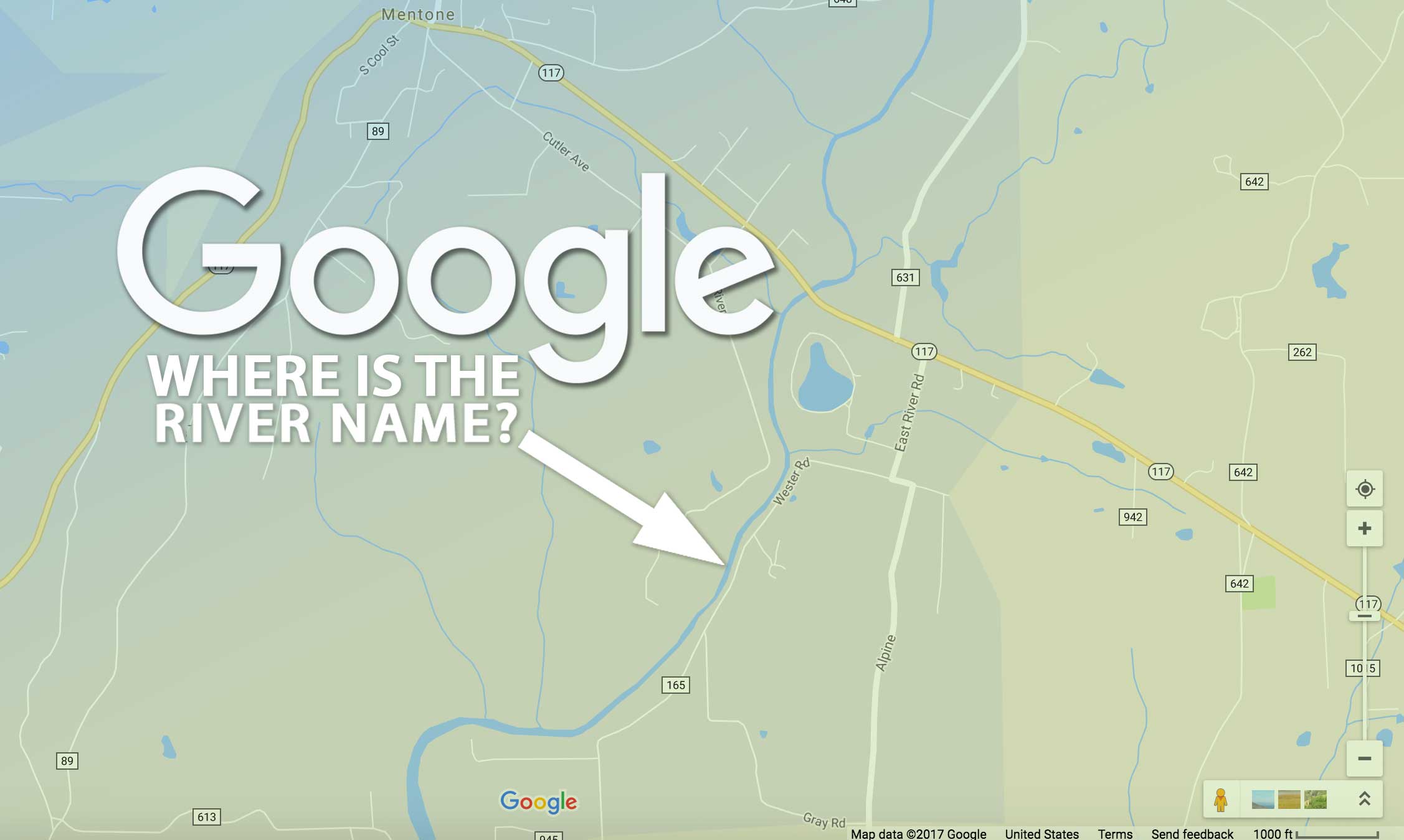
Off to Google Maps I went, to see the river course.
Google Maps
A few years ago I went on a day trip with someone up to Chattanooga and took the back roads to get there, passing through Mentone on the way. I don’t exactly recall passing over a river at any point in that trip. But sure enough, there was one in the Google Map, see?
The thing is, I wasn’t sure if the “Little River” was the thicker blue line meandering from north to south, or if it were one of the smaller tributaries (since they do call it the “little” river).
I figured that information would be in the map, but it wasn’t.
As much as I zoomed in, I never found a label for those waterways. Digging through the controls I found nothing that would let me switch on labels for waterways. So I did some googling and found that users have been complaining about the removal (or lack of detail) in Google’s rivers and streams all the way back to at least 2011.
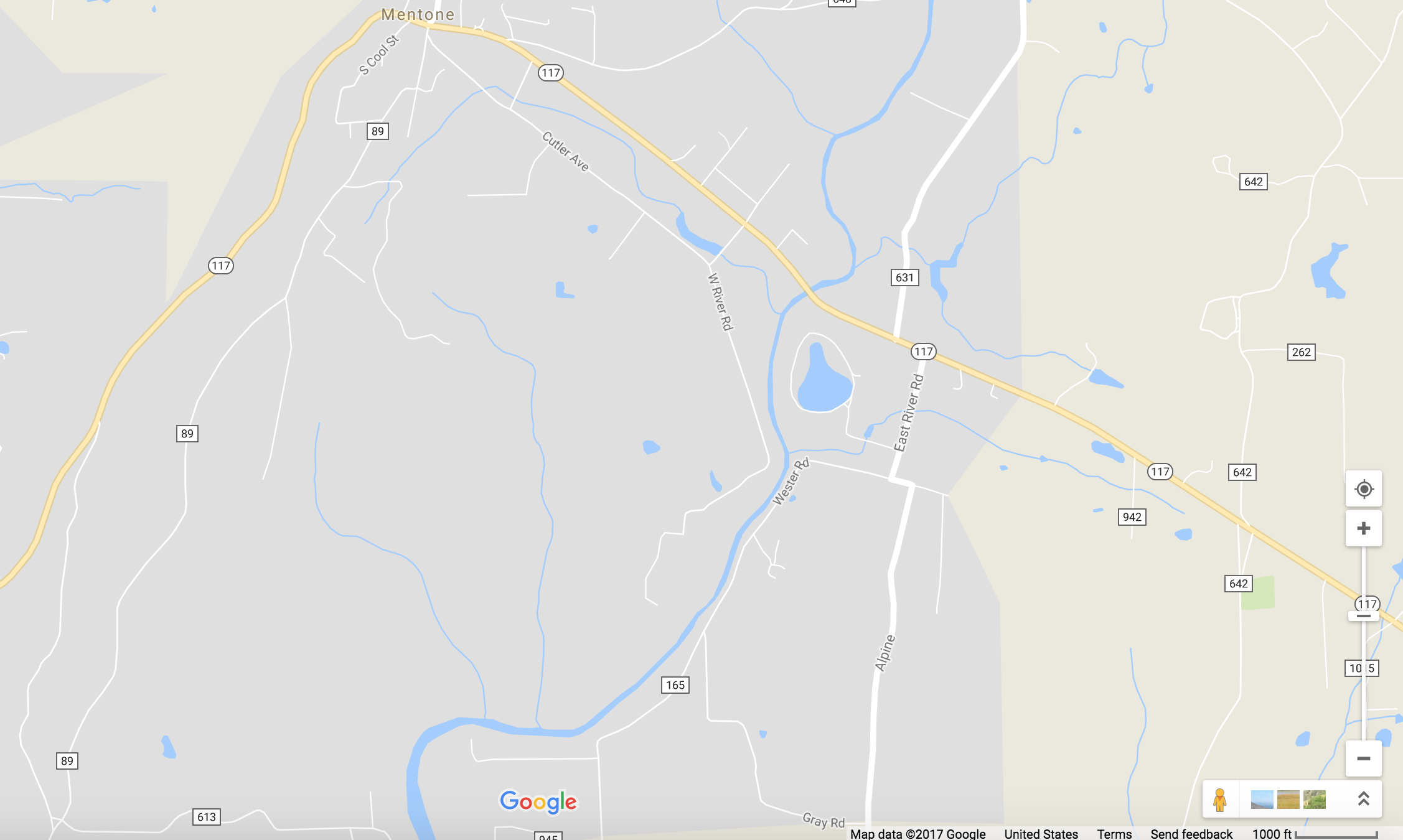
Microsoft Bing
Some of the users in one old thread recommended looking at Microsoft Bing, so I opened a new tab and dialed in to Mentone via that mapping site. It was noticeably worse, as there were no water courses shown at all. See?
I was running out of options.
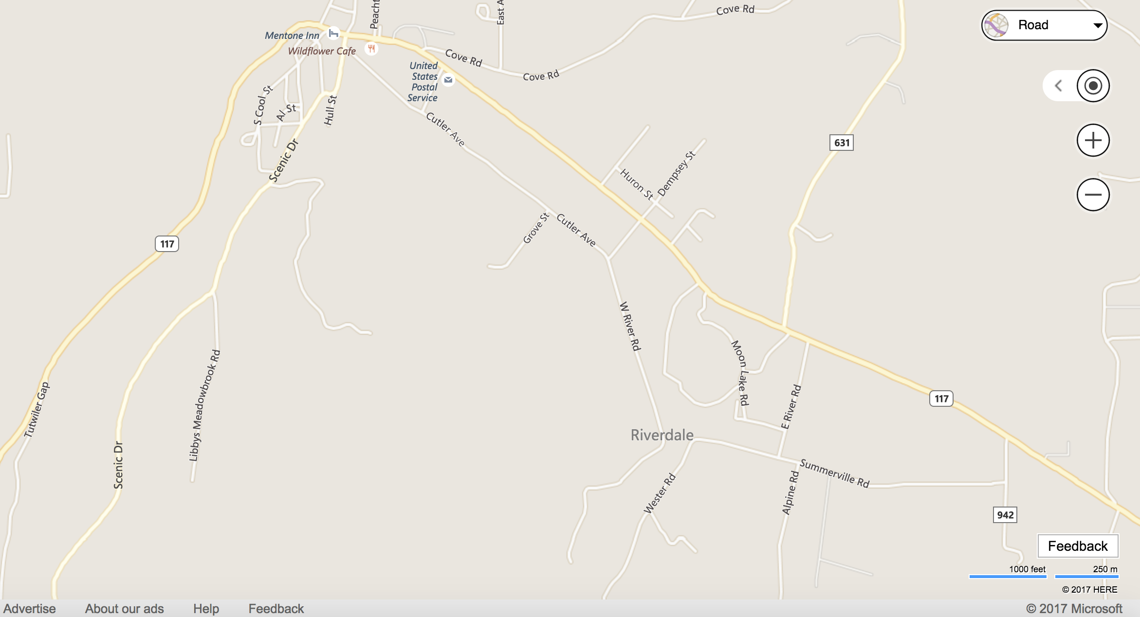
MapQuest
On a whim I dialed up the Great-Granddaddy of internet maps, MapQuest. And guess what? Those old codgers actually had the ding dang river course labeled. Take a look for yourself.
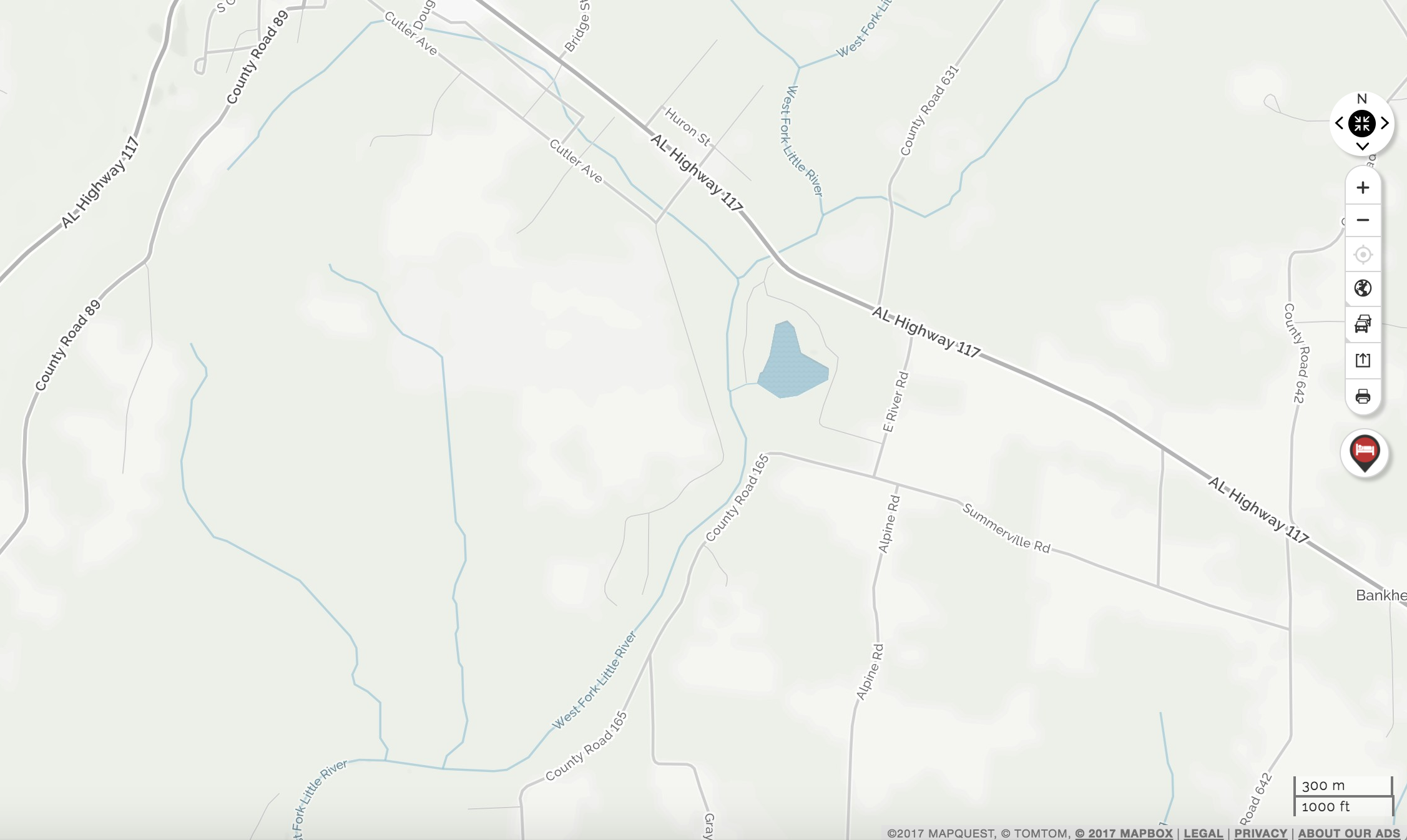
All three of these maps were at about the same scale when I made screenshots. Just so you can better see the MapQuest results I’ve made an enlargement, here you go:
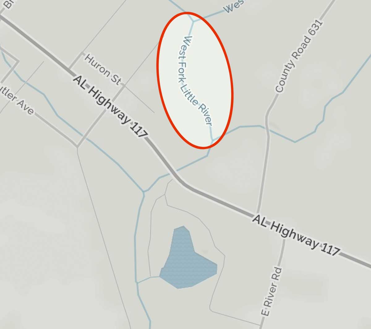
There you go: the big blue line was the Little River (the West Fork to be exact).
So if you’re looking to identify smaller rivers and waterways don’t forget that MapQuest is still in business, even if we all suspect that it’s being run out of the garage of a 60-something Web 1.0 pioneer named Brian, just to give him something to live for. (Verizon bought it back in 2015)
According to Wikipedia MapQuest began using the OpenStreetMap project around 2010. Kicking around the OpenStreetMap maps it’s kind of balky, and I don’t see the river data showing up, so I’m not sure where MapQuest’s river information is coming from but it isn’t apparently from OpenStreetMap. Maybe they just have a copy of the Alabama Atlas & Gazeteer?
Anyway, that’s all I’ve got on this little story, other than to say that maybe I won’t do quite as big a double-take when I see a website using MapQuest instead of Google Maps.
Also, Google Maps: get your shit together, already.
Sheesh.